Why Fleet Safety Requires More Than a Blue Line
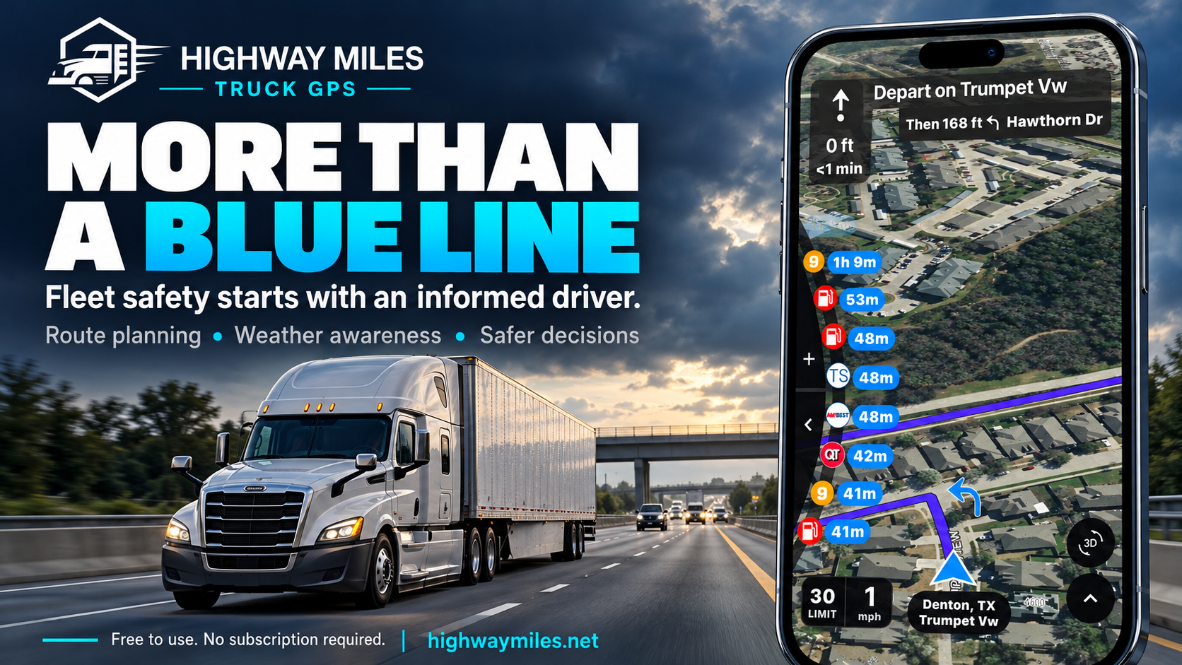
How informed route planning and Highway Miles support safer decisions
A truck can follow the route on its navigation screen and still arrive at a situation the driver was poorly prepared to handle. A low bridge may block the approach. Traffic may be stopped beyond a curve. Freezing rain may have changed the road surface. The address may lead to a customer entrance that cannot accommodate a tractor-trailer.
For fleet owners and safety directors, those possibilities make navigation a safety issue long before a collision occurs. The question is whether the driver has enough useful information, enough preparation, and enough support from dispatch to make a sound decision before the available options narrow.
Commercial routing is the foundation. A complete trip plan also accounts for the driver, the load, changing conditions, stopping options, and the final approach. At Highway Miles, we bring truck routing and relevant trip information together to support that preparation. The blue line matters, but the decisions surrounding it determine how the trip is actually driven.
Start with the truck that is actually making the trip
A route suitable for a passenger car may be unsuitable for a commercial vehicle. Height restrictions, weight limits, trailer length, and cargo restrictions can change which roads are appropriate. Fleet procedures should establish who verifies those details and when the driver must update them. A saved profile deserves another look whenever the vehicle, trailer, or load changes.
The Federal Motor Carrier Safety Administration advises drivers to choose navigation intended for trucks and buses, enter relevant vehicle information before departure, and obey traffic signs and advisories even when navigation gives different guidance. That establishes a practical starting point for a fleet's navigation policy.[1]
Highway Miles supports truck profiles that include height, weight, length, axle count, trailer configuration, cargo, and hazardous-material settings. Those details inform commercial routing. For a fleet, the value starts with making profile verification a routine part of trip preparation, rather than assuming a previous driver's settings still fit today's assignment.[2]
Driver training must also address the limits of the result. A calculated route is guidance based on available information. It cannot authorize travel against a posted restriction or replace a required permit. If the road and the screen disagree, the fleet must support the driver's decision to stop safely and resolve the conflict.
Low bridges can turn one routing mistake into a public hazard
On August 31, 2023, an overheight tractor-trailer struck the South Broadway overpass in South Nyack, New York. The damage required a later 16-hour closure of all southbound I-87/I-287 lanes on September 9 so crews could remove two damaged girders and stabilize the overpass. The consequences extended well beyond the truck and its delivery.[3]
The problem continues. In July 2026, New York State reported 310 bridge strikes during 2025 and again urged truck operators to use commercial navigation. That record demonstrates why clearance awareness remains a serious operational concern.[4]
Highway Miles combines the vehicle profile with commercial routing and available low-clearance information to help drivers identify concerns while planning and reviewing a trip. Bringing that information into the navigation experience gives clearance checks a place in the driver's normal workflow.[5]
The fleet's responsibility is to make that review meaningful. Drivers need to know their actual operating height and understand that missing clearance information is not confirmation that a road is suitable. When clearance is uncertain, resolve it before committing to the approach. Trying to recover after reaching an unsuitable bridge can introduce additional hazards, including traffic obstruction and difficult backing maneuvers.
Treat congestion and construction as safety information
Traffic information matters for more than arrival time. A queue changes the driving task, sometimes well before the driver reaches the work zone or incident responsible for it. Fleets should train drivers to anticipate slowing traffic, follow temporary controls, and preserve the space needed to respond.
On June 25, 2015, near Chattanooga, Tennessee, a tractor-trailer struck vehicles in traffic slowed by construction and a work-zone lane closure on Interstate 75. Six people died. The National Transportation Safety Board attributed the driver's failure to respond to performance impairment likely associated with fatigue and methamphetamine use.[6]
That finding matters. The crash cannot honestly be reduced to a missing navigation warning. It illustrates both the danger of a traffic queue and the need for driver fitness, effective fleet oversight, and appropriate speed. Route information supports those protections; it cannot compensate for an impaired driver.
Highway Miles displays available congestion, incident, construction, and closure information within the navigation experience. Drivers can review reported conditions and consider alternatives when available. Because reports may be delayed or incomplete, an apparently clear map is never evidence that the road ahead is clear.[7]
Dispatch should treat a deteriorating traffic situation as a reason to reassess the plan. Revising an appointment is preferable to expecting the driver to recover lost time through faster driving or a hurried diversion.
That reassessment should include what comes after the delay. Will the driver still reach the intended rest stop with adequate time? Will the receiver remain open? Is the proposed bypass suitable for the vehicle? Answering those questions before the truck leaves the main route gives dispatch a useful role in safety and helps prevent one disruption from creating several rushed decisions.
Weather can change whether a route should be driven
On February 11, 2021, a chain of crashes on Interstate 35 West in Fort Worth, Texas, involved 130 vehicles and killed six people. The NTSB determined that ice on an elevated roadway caused drivers to lose control. Inadequate monitoring and treatment contributed to the hazardous conditions, while speeds too fast for the winter weather contributed to the severity.[8]
The lesson for trip planning is that a road can remain geographically correct while conditions make continued travel unsafe. Knowing which exit to take does not answer whether the driver should proceed, delay departure, or stop at a suitable location before conditions worsen.
Highway Miles places available weather radar alongside the route so drivers can review developing conditions in the areas they expect to reach. Seeing weather in the context of the trip supports a more useful discussion with dispatch about timing and stopping options.[9]
Radar does not measure the grip available under a truck's tires. Drivers and dispatchers still need official forecasts, warnings, current road information, and observations from the road. Weather data may be delayed or incomplete. A forecast should trigger judgment, not create confidence that every hazardous patch will appear on a screen.
A fleet should decide in advance how weather concerns are escalated and who contacts the customer when the schedule changes. Drivers need clear authority to stop when conditions warrant it, supported by a practical place to do so.
Review the safety of a detour before committing to it
When an interstate closes, the temptation is to find any road that keeps the truck moving. A diversion can introduce unfamiliar intersections, restricted bridges, sharp turns, or a difficult approach to the customer. The time shown on a proposed alternative is only one part of the decision.
Highway Miles includes Avoid and Route Through Here controls that allow drivers to adjust a planned route. These tools can help a driver incorporate a route preference or a confirmed approach into the trip. They are especially useful when the driver has relevant local knowledge that a general route calculation cannot explain.[2]
The resulting route still needs review. A point dropped on the wrong side of a divided road or near a passenger entrance can create a different approach from the one intended. A route chosen to avoid congestion must remain appropriate for the truck and consistent with official restrictions and any permit requirements.
Fleets can establish a simple expectation: significant route changes deserve a fresh review, with dispatch assistance when needed. The driver's task is to reach a safe place to assess the change, not to solve a complicated map problem while steering through unfamiliar traffic.
Plan stopping options before they become urgent
A delivery plan is incomplete if it assumes that a suitable stopping place will appear whenever the driver needs one. Fuel, rest, meals, and unexpected delays all affect the trip. A driver approaching a planned break should already have a primary stopping option and a reasonable alternative.
Highway Miles brings truck stops, rest areas, fuel locations, repair facilities, and other driver services into the navigation map. Available time and distance information helps drivers compare upcoming options in relation to the route. Multiple stops can be incorporated into the trip before departure.[10,2]
Planning those stops creates room to adapt when a customer takes longer than expected or traffic consumes the original schedule. A listed parking location, however, does not establish that a space is currently available. Access and services should be verified when they are critical to the plan. Dispatch must also account for the driver's actual available duty time; a navigation ETA alone cannot establish compliance or readiness to continue.
A backup stop should be specific enough to use. Identify its location, the direction of access, and any information that needs confirmation. Allow for the possibility that the first choice is full or closed. Leaving that work until the driver is tired and nearly out of options defeats much of the purpose of trip planning.
Include the final approach in the safety plan
Reaching the customer's street is only part of arrival. A facility may have separate entrances for employees, visitors, and commercial deliveries. An incorrect entrance can leave a driver facing a tight turn, an unsuitable parking lot, or a backing maneuver near people and parked vehicles.
Highway Miles provides access to Google Street View for destination context. Before departure or while safely parked, drivers can examine the surroundings and compare what they see with the receiver's truck-access instructions. A visual preview can make an unfamiliar location easier to understand.[11]
Imagery may be old, and a visible gate may no longer be the receiving entrance. Drivers should confirm uncertain access with the facility before arrival. Fleets should make accurate entrance directions part of the dispatch information and collect corrections after deliveries. That operational knowledge remains valuable even when the navigation system correctly locates the street address.
Give drivers useful information without adding screen work
A safety discussion about phone navigation must address attention. A driver who searches for weather, compares parking options, or edits stops while moving is taking attention away from driving. Putting information in one application does not make every interaction appropriate behind the wheel.
Highway Miles brings routing, traffic, weather, and truck services into a unified experience and provides spoken directions and lane guidance. That arrangement is intended to make relevant trip information easier to access. Fleets should pair it with a clear operating routine: configure the route and audio before moving, secure the device appropriately, and reserve detailed review or changes for a safe stop.[2]
FMCSA specifically advises against entering addresses or other navigation information while driving.[1] Training should include practice while parked so drivers understand the controls before using them on a working trip. If a turn is missed, the priority is to maintain control and find a safe continuation. Abrupt braking or a sudden lane change to recover the route can create a far greater problem than the missed turn.
A useful evaluation asks how much interaction normal tasks require and whether drivers understand the guidance. A long feature list alone cannot answer those questions.
Make navigation part of the fleet safety program
Providing an app is a starting point. Fleets should establish a repeatable trip-review process covering the vehicle profile, known restrictions, weather, traffic, planned stops, and destination access. Drivers also need a dependable way to raise concerns, with dispatch prepared to help verify information and adjust the schedule.
After a trip, useful feedback includes unexpected restrictions, incorrect entrances, unsuitable stopping locations, and moments when instructions were unclear. Fleet leaders should use those reports to improve driver preparation and customer directions. An uneventful delivery is an opportunity to learn from a resolved problem before another driver encounters it.
Training should also make uncertainty acceptable to report. A driver who questions an entrance, a clearance, or deteriorating weather is giving the fleet information it needs. If the response is always pressure to keep moving, the written safety policy has little practical value. Supervisors should judge how a concern was handled, including whether the driver obtained help before entering a situation that was difficult to reverse.
Highway Miles is available on iOS and Android, with a free, ad-supported phone-navigation plan that requires no subscription. That gives fleets an accessible way to evaluate the workflow with their drivers. A practical trial should examine route suitability, ease of use, and the quality of preparation it supports.[11]
Evaluation should focus on how the tool is used. Record restrictions identified before departure, customer-access problems, and route changes resolved before the truck reaches a difficult location. Review those findings with drivers and dispatch. This gives the fleet a practical basis for improving its process while keeping expectations grounded in observed performance.
The standard should be a driver who understands the route, knows where uncertainty remains, and has the support to change the plan safely. Highway Miles helps bring the information for those decisions into the trip. Fleet leadership must make the time and judgment to use it part of the job.
Robert Phillips is a working truck driver and co-founder of Highway Miles, a commercial truck navigation app for iOS and Android.
Learn more at highwaymiles.net.
Sources
[1] FMCSA guidance on safe use of GPS navigation systems
[2] Highway Miles navigation features and truck profiles
[3] New York State bridge-strike announcement including South Nyack incident, November 5, 2023
[4] New York State bridge-strike campaign and 2025 totals, July 27, 2026
[5] Highway Miles low-bridge and clearance information
[6] NTSB Chattanooga work-zone crash investigation HWY15MH009
[7] Highway Miles traffic and road-condition features
[8] NTSB Fort Worth ice-crash investigation HWY21FH005
[9] Highway Miles weather radar and data limitations
[10] Highway Miles truck stops and driver services
[11] Highway Miles tutorial including Street View and free phone plan