

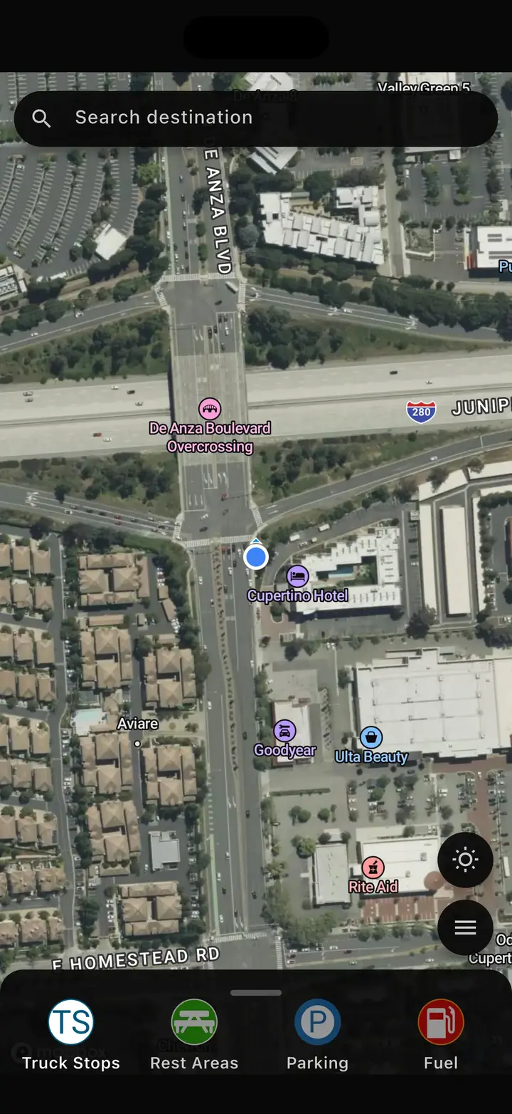
Free commercial truck GPS built for CDL drivers

Build truck-specific routes for your semi truck using height, weight, length, axle, trailer, cargo, and hazmat settings. Then navigate with turn-by-turn voice guidance, lane guidance, traffic, weather, and low-clearance information in one unified experience.

Built around your truck

Route using your vehicle profile, trailer, cargo, and hazmat settings.

One unified screen

Keep route, traffic, weather, services, and alerts together in one place.

Available on iOS and Android

Built around your truck

Every route begins with your truck profile

Enter your vehicle details once, then let Highway Miles calculate routes around truck restrictions, low bridges, weight limits, and other applicable roadway constraints whenever possible.

Truck Route Planner

Plan one stop or an entire day of deliveries with an unlimited-stop route planner built around a driver's actual workday.

Learn moreShow less about Truck Route Planner

Highway Miles includes an unlimited-stop truck route planner for drivers who need more than simple Point A-to-Point B navigation.

Add multiple destinations, reorder your stops, optimize your route, and start navigation from the same app.

Whether you're running OTR, regional, dedicated, LTL, local delivery, or multiple pickups and drops, Highway Miles gives you the flexibility to build the trip around your actual workday.

Unlimited Stops. No Artificial Route Limits.

Plan as many stops as your trip requires without being forced into a restrictive route-planning workflow.

Explore the Truck Route Planner →

Low Bridge GPS

Use your truck profile and commercial routing information to identify low-clearance concerns along a planned route.

Learn moreShow less about Low Bridge GPS

Low bridges are one of the most serious risks facing drivers who rely on ordinary passenger navigation.

Highway Miles combines your truck profile with commercial routing and low-clearance information to help identify clearance concerns along your route.

See low-clearance information directly within the navigation experience instead of relying on a separate app or trying to search for bridge information while driving.

Highway Miles is a navigation aid. Drivers must always follow posted signs, roadway restrictions, permits, and applicable regulations.

Explore Low-Bridge Navigation →

Live Weather Radar

See rain, thunderstorms, snow, and changing conditions along your route without switching to a separate weather app.

Learn moreShow less about Live Weather Radar

You shouldn't have to switch between navigation and a separate weather app to find out what you're driving toward.

Highway Miles brings live weather radar directly into the truck navigation experience so drivers can see rain, thunderstorms, snow, and changing conditions around their route.

Use weather information to understand what is developing ahead - not just what is happening at your current location.

Know What's Ahead

View weather conditions along your trip and make better decisions before severe weather becomes the next delay.

Explore Truck Weather Radar →

Traffic and Road Conditions

See traffic, accidents, construction, road conditions, and route incidents inside the navigation experience.

Learn moreShow less about Traffic and Road Conditions

See conditions developing ahead and understand how they affect your trip and estimated arrival time.

Instead of simply knowing that traffic exists, Highway Miles is designed to give drivers more useful road intelligence while they navigate.

Available Traffic and Road Information

  • Traffic congestion
  • Accidents and incidents
  • Construction
  • Road closures
  • Changing ETA information
  • Route alternatives
  • Weather conditions
Explore Traffic & Road Conditions →

Truck Stops and POIs

Find truck stops, parking, fuel, weigh stations, and driver services directly from the navigation map.

Learn moreShow less about Truck Stops and POIs

Drivers need more than directions.

Highway Miles makes truck-relevant points of interest available directly from the navigation map so you can find services without repeatedly leaving your route screen.

Search for truck stops, truck parking, fuel, rest areas, weigh stations, truck washes, repair facilities, restaurants, and other driver services.

Upcoming POIs can be displayed with time or distance information so you can decide where to stop before you reach it.

Explore Truck Stops & POIs →

Offline Map Downloads

Download supported map data before a trip so map coverage remains available when the signal becomes weak.

Learn moreShow less about Offline Map Downloads

Download map data for supported states, provinces, or regions before entering areas where mobile coverage may be unreliable.

Downloaded maps can keep map coverage available, but route calculation, rerouting, traffic, weather, and other live services may still require a data connection.

Plan and review the route before driving into a low-connectivity area, and always follow posted roadway information.

Learn about Offline Map Downloads →

Route Sharing

Share trip information with dispatch, customers, or family without requiring them to install another navigation app.

Learn moreShow less about Route Sharing

Highway Miles allows drivers to share trip information without requiring the person receiving the route to install another navigation app.

Use route sharing to keep dispatchers, customers, family members, or other authorized recipients informed about your trip.

Explore Route Sharing →

One Navigation Screen

Keep navigation, weather, parking, traffic, and truck services together instead of jumping between separate apps.

Learn moreShow less about One Navigation Screen

Professional drivers often end up running one application for navigation, another for weather, another for parking, another for traffic, and another for truck services.

Highway Miles is designed differently.

Truck navigation, route planning, weather, road conditions, POIs, and alerts are integrated into one truck-focused navigation experience.

Spend less time digging through menus and more time seeing the information that matters to your trip.

Explore Commercial Truck Navigation →

Intelligent navigation that adapts

Stay informed when road conditions change

Highway Miles brings available traffic, incident, construction, closure, and weather information into the navigation view so you can understand changing conditions and decide whether to stay on course or review another route.

Route adaptation

Review route alternatives when available traffic, incident, construction, or closure information affects the trip.

Driver-focused alerts

View available low-clearance, restriction, incident, weather, service, and stop information along the trip.

One view for everything

Route guidance, services, weather, and alerts stay visible without bouncing between disconnected screens.

Navigation features

One app for trip planning, navigation, and road intelligence

Highway Miles brings together smart routing, a clean navigation screen, and the information drivers need from departure to arrival.

  • Turn-by-turn spoken directions
  • Lane guidance
  • English and Spanish language support
  • Speed-limit notifications
  • Updated ETA information
  • Live weather radar
  • Satellite view and 2D map view
  • Street View for destination and stop context
  • Offline maps by state or province
  • Truck stops, parking, fuel, rest areas, and services
  • Multi-stop route planning
  • Unlimited waypoints and route optimization
  • Avoid and Route through here controls

FAQ

Highway Miles questions

What makes Highway Miles different?

Highway Miles is built around your truck profile and keeps routing, traffic, weather, services, and navigation features together in one unified experience.

What truck details can I enter?

You can enter vehicle height, weight, length, axle count, cargo type, trailer configuration, and hazmat settings.

Does the app reroute around delays?

Highway Miles uses available traffic and road information to update the trip and may offer route alternatives when possible. Live data and coverage vary, so verify safety-critical conditions with current official sources.

What works after I download maps?

You can download supported map data by country, state, province, or region before a trip. Route calculation, rerouting, traffic, weather, and other live services may still require a data connection, so review the route before entering a low-connectivity area.

How much does Highway Miles cost?

Highway Miles is free to download and use. The free ad-supported plan includes every Highway Miles navigation feature, including commercial truck routing, unlimited-stop route planning, live weather radar, traffic alerts, low-clearance information, weigh-station locations, truck stops, parking locations, and live route sharing.

Drivers who prefer to use Highway Miles without advertisements can upgrade to the optional Ad-Free plan for $5.99 per month. Both plans provide access to the same navigation features. The only difference is that the free plan displays ads and the Ad-Free plan does not.

Download Highway Miles

Expect more. Get more. Drive smarter.

Download Highway Miles for truck-profile routing, advanced trip planning, turn-by-turn navigation, weather radar, offline map downloads, and truck-focused POIs.